Property History
During the nineteenth century, the township of Bothwell was divided into a number of sections and individual allotments. Maps Bothwell B37 and Bothwell B38, held by the Tasmanian Archives, identify the original grantees or owners and the size of each allotment.
The property histories on this website present a chronological record of each property to 1920, documenting purchases and sales, ownership, tenancy, landlords, and other significant events associated with each property.
This is an ongoing research project, and additional information will be added as further records and sources are discovered.

Tasmanian Archives Map: Bothwell B37, AF819/1/26 (modified)
Copies of this map may be made from the Tasmanian Archives website; high-resolution digital copies and colour reproductions can be obtained from the TASMAP eShop at: https://www.tasmap.tas.gov.au. View original map on the Tasmanian Archives website: https://libraries.tas.gov.au/Digital/AF819-1-26. All sections below have been modified from the above map.
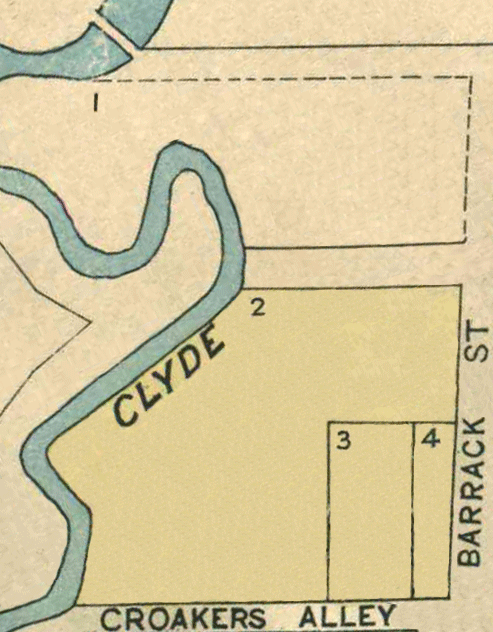
Map 1 - Sections 1 to H
[1] Barrack St - purchased by John McWaide
[2] Crokers Alley - granted to Mary Ann (Allen) White
[3] Crokers Alley - granted to John White & Simon Arnett
[4] Crokers Alley - granted to Simon Arnett & William Tasman Mason
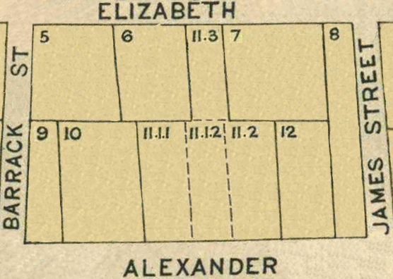
[5] Elizabeth St- granted to George Swindells
[6] Elizabeth St - purchased by William Moyes
[7] Elizabeth St - granted to Thomas Anderson
[8] Alexander St- granted to Thomas Young
[9] Alexander St - granted to John White & Simon Arnett
[10] Alexander St - granted to Richard Allen
[11] Alexander St - granted to James Fisher
[12] Alexander St - granted to James Macdonald
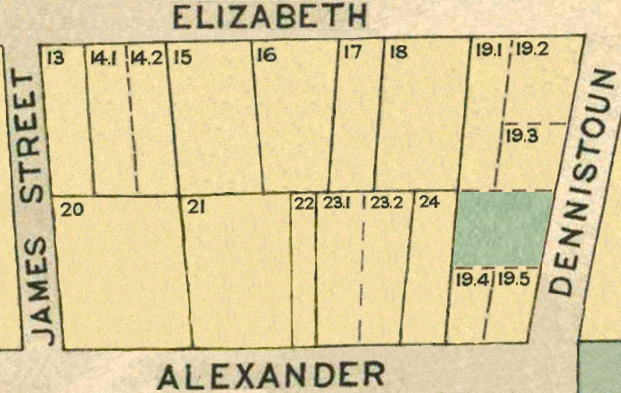
[13] Elizabeth St - granted to Mary Ann (Whiteway) Arnett
[14] Elizabeth St - granted to John Stevens
[15] Elizabeth St - granted to James Dalwood
[16] Elizabeth St - granted to George Branch
[17] Elizabeth St - granted to Simon Arnett
[18] Elizabeth St - granted to John Merry
[19] Dennistoun Rd - granted to Robert Blake
[20] Alexander St - granted to Simon Arnett & William Tasman Mason
[21] Alexander St - granted to Thomas Young
[22] Alexander St - granted to David Wylie
[23] Alexander St - granted to Robert Blake
[24] Alexander St - granted to Charles William Lewis
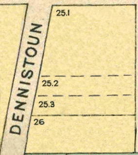
[25] Dennistoun Rd- granted to David Norton
[26] Dennistoun Rd - granted to Edward Bowden
[B1] Alexander St - granted to William Moyes
[B2] Barrack St - Municipal Reserve
[B3] Dalrymple St - granted to William Henry Sealy
[B4] Dalrymple St- granted to William Wood Hughes
[B5] Dalrymple St - granted to Simon Arnett & William Tasman Mason
[B6] Patrick St- granted to Charles Cockburn Shaw

[C1] Alexander St - granted to Archibald McDowall
[C2] Dalrymple St- granted to Robert Parkinson
[C3] Dalrymple St - granted to Alexander Denholm
[C4] Dalrymple St - granted to William Maskell
[C5] Patrick St - granted to Ann Alice (Taylor) Savage
[C6] Patrick St - part of location to Andrew Reid
[C7] Alexander St - granted to John White
[C8] Patrick St - granted to William Westley
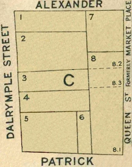
[D1] Patrick St - granted to John Vincent

Section E
[E1] Patrick St - granted to Thomas Roadknight
[E2] Patrick St - granted to George Larkins
[E3] Arthur Cres - granted to Thomas Roadknight
[E4] Arthur Cres - granted to Robert Barr


[G1] High St - granted to Robert Barr
[G2] High St - granted Muriel Amy (Blake) Ellis
[G3-G5] High St - granted to Edward Bowden
[G6] High St - granted to Edward Andrews

[H1] High St - granted to Robert Patterson
[H2] High St - granted to Edward Bowden
[H3] High St - granted to Henry Mylam Cockerill
[H4] High St - granted to Henry Mylam Cockerill
[H5] High St - granted to Phineas Moss
[H6] High St - granted to Phineas Moss
[H7] High St - granted to John McRa
[H8] High St - granted to John McRa
[H9] High St - Baptist Society
[H10] Franklin St - granted to John Young
[H11] Franklin St - granted to Thomas Frederick Marzetti
[H12] Franklin St - granted to Thomas Frederick Marzetti
[H13] Franklin St - granted to Thomas Frederick Marzetti
[H14] Franklin St- granted to Thomas Frederick Marzetti
[H15] Franklin St - granted to Robert Patterson
