Property History
During the 1800’s the township of Bothwell was divided into several sections and individual lots.
Maps - Bothwell B37 and Bothwell B38 - are available at the Tasmanian Archives and include names of the grantees or owners and lot sizes.
Information compiled on this website are timelines of occurrences for each property until 1899 - who bought and sold, who owned, who rented and who were landlords etc.
This is a work in progress and will be continually added to and updated.
Map 1

Map 1 - Sections 1 to 26 and B to H
Map 1 - Sections 27 to 30 and I to A
Tasmanian Archives Map - Bothwell B37, AF819/1/26 (modified)
Copies of this map may be made from the Tasmanian Archives website but high-resolution digital copies and colour reproductions can be obtained from the TASMAP eShop at: https://www.tasmap.tas.gov.au.
View original map on the Tasmanian Archives website https://libraries.tas.gov.au/Digital/AF819-1-26
Map 2
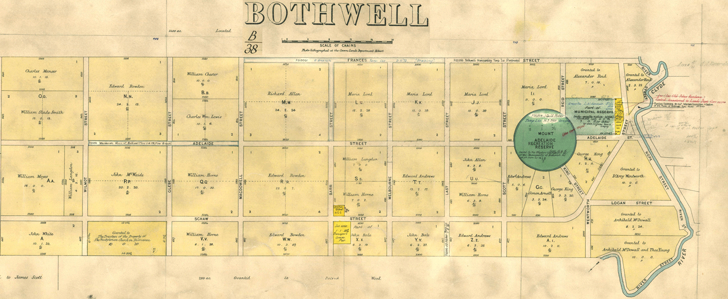
Map 2 - Sections 31 to 35 and A to Zz
Tasmanian Archives Map - Bothwell 2 (B38), AF819/1/27 (modified)
Copies of this map may be made from the Tasmanian Archives website but high resolution digital copies and colour reproductions can be obtained from the TASMAP eShop at: https://www.tasmap.tas.gov.au.
View original map on the Tasmanian Archives website https://libraries.tas.gov.au/Digital/AF819-1-27